 Search


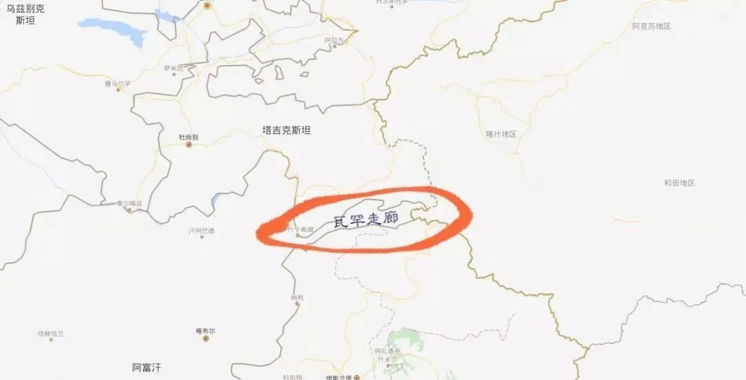
- The Wakhan Corridor is about 300 kilometers long from east to west, and the narrowest point from north to south is only 15 kilometers
- China and Afghanistan are adjacent to each other at the eastern end of the long and narrow Wakhan Corridor, with a borderline of only 92.45 kilometers
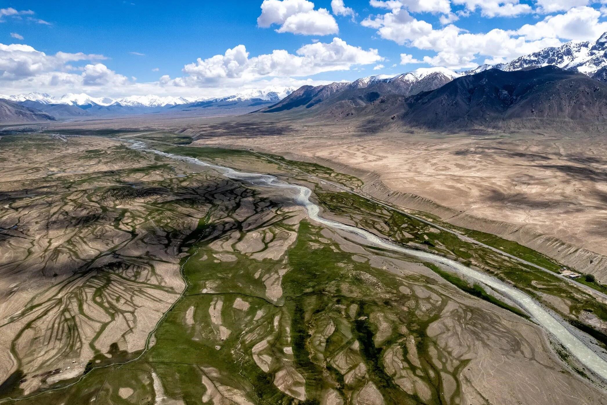
The Wakhan Corridor north of the Pamir Plateau, also known as the Afghanistan Corridor and the Wakhan Pamir, is located in a valley between the southern end of the Pamir Plateau and the northeastern section of the Hindu Kush Mountains. The southern edge is adjacent to Tajikistan, the eastern section of the Hindu Kush Mountains is adjacent to Pakistan and Pakistan-controlled Kashmir in the south, the Penchi River and its tributary Pamir River in the upper reaches of the Amu Darya River in the west, and the Tashkurgan, Xinjiang Uygur Autonomous Region, China in the east. Tajik Autonomous County. It starts from the Penchi River in the upper reaches of the Amu Darya River and its tributaries, the Pamir River, and connects to the Tashkurgan Tajik Autonomous County, Xinjiang Uygur Autonomous Region, China in the east.
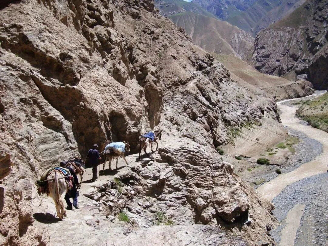
It was Chinese territory in history, part of the ancient Silk Road, and an important channel for exchanges between Chinese civilization and Hindustan civilization.
Faxian, an eminent monk in the Eastern Jin Dynasty, Xuanzang, an eminent monk in the Tang Dynasty, and An Xigao, the founder of the Chinese translation of Buddhist scriptures in the Western Regions, all visited here to study Buddhism in India.
The 300-kilometer Wakhan Corridor is in Afghanistan, the narrowest point is only 15 kilometers, and the widest point is about 75 kilometers. After flowing 160 kilometers from east to west, the Wakhan River empties into the Pamir River near the main local village of Qal'eh-ye Niaz Beyg.
Historically, Congling-Pamir Plateau was a part of China's territory. In the Tang Dynasty, China set up the "Congling Guarding", and its jurisdiction was the entire western region of Xinjiang, including the Pamir region.
In the 24th year of Qianlong's reign (1759), the Qing government unified the vast areas in the north and south of the Tianshan Mountains and consolidated the legal status of the Pamirs in the Chinese territory after quelling the rebellion of the Dzungar tribe and Daxiaohezhuomu.
The Qing government has established officials and garrisoned troops in the Pamirs for a long time, and has always exercised effective jurisdiction over the Pamirs.
In the 1880s, Russia's conquest of Kazakhstan, the three Khanates in Central Asia and Turkmenistan wanted to occupy the Pamirs militarily. At the same time, British influence has also expanded into Afghanistan and infiltrated the Pamirs.
After Zuo Zongtang recaptured Xinjiang, he sent troops across the Selkur Mountains to set up an outpost on the Pamir Plateau. Among them, Suman Tashi also set up a boundary monument during Qianlong. However, at that time, the Russian troops continued to enter this part of the Pamirs. After several battles between the Chinese and Russian troops, the Qing army was defeated and withdrew to the east of the Selkur Mountains.
In 1893, the neighboring countries and Britain and Russia saw that the Qing troops could not stand west of the Selkur Mountains, so Russia and Britain signed a treaty to divide this part of the Pamirs, and the Wakhan Corridor was assigned to Afghanistan as a space between Russia and Britain. buffer.
In the end, China barely preserved the Pamir Plateau in this section of Tadunbash, which is the area where China's Xinjiang borders with Tajikistan and Afghanistan's Wakhan Corridor today.
After the partition between Britain and Russia, the Pamir and the Qing Dynasty protested, but the national strength was weak and there was nothing to do. Before the establishment of the Republic of China, it had lost control.
Not only that, but now in the Hunza area of Pakistan, China also had suzerainty before 1894. At that time, Hongza paid a tribute of one qian and five taels of alluvial gold to the Qing government every year (receiving more than 10 times the reward).
On March 11, 1895, Britain and Russia signed the "Agreement on the Sphere of Influence in the Pamirs" through an exchange of letters. Through this agreement, the two countries divided the Pamirs, which belonged to the Chinese territory. The agreement stipulated that "the spheres of influence of Great Britain and Russia east of Lake Victoria (Zor-Cool) shall be bounded by the following line extending from a point near the eastern end of the lake along the ridge to the latitude of the lake. South of Binderski and the Orta-Bell Pass.
From here the line runs along the same ridge south of the above-mentioned parallel, and when it reaches the parallel, it descends along the lateral ridge of the mountain to Kizil Rabat on the Aksu River, if the place lies south of the above-mentioned parallel , then it extends eastward from here to meet the Chinese border.
If it is found that Kizil Rabat is located north of the latitude of Lake Victoria, the line shall be drawn at the most suitable point on the banks of the Aksu River to the south of this latitude, and then extended in the above-mentioned direction".
With regard to the issue of this partition involving China, the agreement stipulates that "the joint committee will be responsible for reporting any facts that can be determined on the spot regarding the situation on China's borders, so that the two governments and the Chinese government may, in the most appropriate manner, decide on China's territorial borders. reach agreement within the limits set forth above".
In fact, when Britain and Russia divided the Pamirs, it was on the eve of the Sino-Japanese Sino-Japanese War, and the Qing government of China was unable to look westward. Despite this, the Chinese government protested and negotiated with Britain and Russia at that time. The 1963 "Boundary Treaty between the People's Republic of China and the Kingdom of Afghanistan" confirmed that the line of actual control between the two sides was the basis for demarcation. Editor/He Yuting
Comment


 Praise
 Collect
 Comment

 Share
Share


Write something~