 Search


- Karez, the Great Wall, and the Beijing-Hangzhou Grand Canal are known as the three great projects of ancient China
- As an artificial irrigation facility, Karez is closely related to the life of the Turpan oasis
The Great Wall of China has a total length of nearly 10,000 kilometers. It starts from Shanhaiguan Pass in Qinhuangdao, Hebei Province in the east, and ends at Jiayuguan Pass in the west. These are the two largest passes of the Great Wall built in the Ming Dynasty. The Great Wall in Beijing is more than 600 kilometers long. The famous ones are Badaling Great Wall and Jinshanling Great Wall , Simatai Great Wall, Mutianyu Great Wall, Juyongguan Great Wall and Jiankou Great Wall, etc. The Great Wall was built in the 7th century BC. At that time, the princes in northern China were divided into separate regimes. In order to defend against the invasion of neighboring princes, they successively built sections of defensive walls on their respective territories. At the same time, the north of the three vassal states of Yan, Zhao, and Qin are neighbors of the Huns, who are mainly nomadic among the ethnic minorities. In order to defend against the harassment of the slave owners of the Huns, each of the three countries built the Great Wall on their weak sides. .
In the 3rd century BC, Qin Shihuang unified China and connected sections of the Great Wall, which became the foundation of the current Great Wall. Later, after successive additions to the Ming Dynasty, it was built as it is now. It starts from Shanhaiguan in the Bohai Bay in the east, passes through Hebei, Beijing, Shanxi, Shaanxi, Inner Mongolia, and Ningxia to Jiayuguan in Gansu, passes through high mountains, mountain streams and canyons, and is about 12,000 miles long, so it is called the Great Wall.
This is a great miracle in the world, and the Great Wall has attracted worldwide attention. As everyone knows, there used to be a mysterious underground Great Wall in Chinese history. It was built two thousand years ago, and it is still making great contributions to us. It is Karez.
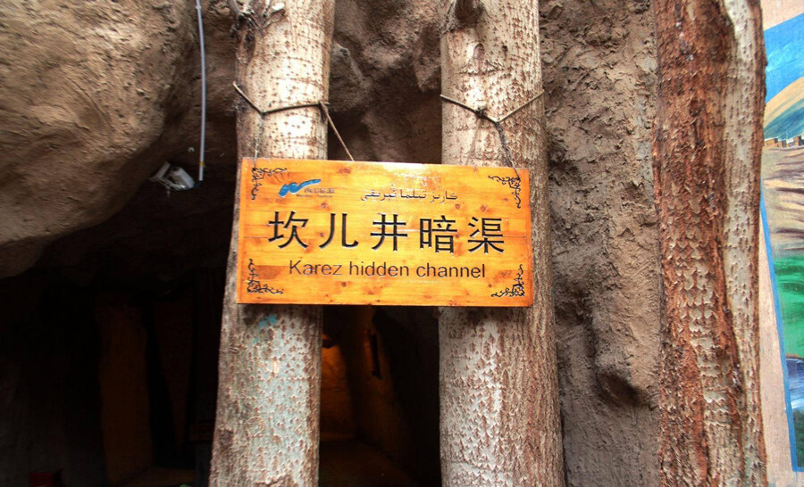
Karez
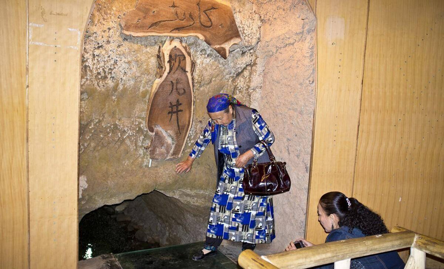
There are nearly a thousand Karez wells in Turpan, with a total length of about 5,000 kilometers. The structure of Karez is generally composed of four parts: vertical shafts, underground channels, surface channels and dams (small reservoirs). The Bogda Mountain in the north of the Turpan Basin and the Karawucheng Mountain in the west have a large amount of accumulated water in spring and summer. Snow and rain flowed down the valley and dived under the Gobi Desert. People use the slope of the mountain to create Kaner skillfully, and lead the subsurface flow to irrigate the farmland. Kaner does not evaporate a large amount of water due to heat and strong winds, so the flow is stable and gravity irrigation is guaranteed.
Karez well was recorded as early as in "Historical Records", and it was called Jingqu at that time. Most of the existing Karez wells in Turpan were built successively since the Qing Dynasty. Today, there are still large areas of oasis fertile land being watered. Wudaolin Kanerjing in the suburbs of Turpan and Karez in Wuxing Township are available for sightseeing. The name of Karez, Xinjiang Uyghur is called Kanerzi, Iranian Persian is called Kannazi, and Soviet Russian is called Kanyaliz. From the phonetic point of view, although they are different from each other, the difference is not big.
Chinese in Xinjiang, China is called Kanerjing or Kaner for short. The provinces in mainland China have different names; for example, Shaanxi is called Jingqu, Shanxi is called Shuixiang, Gansu is called Baiyan Chuanjing, and some places are called underground channels.
The reason why Karez wells were built in large numbers in the Turpan Basin is inseparable from the local natural and geographical conditions. Turpan is one of the extremely arid areas in China, with an annual precipitation of only 16 millimeters and an evaporation of 3,000 millimeters, which can be called the dry pole of China. However, Karez wells transport water through underground canals, which are not affected by seasons and sandstorms. The evaporation is small and the flow is stable, so they can be irrigated by gravity all year round.
Although Turpan is hot and rainless, there are Bogda Mountains in the north of the basin and Karawucheng Mountains in the west. In summer, a large amount of snowmelt and rainwater flow into the basin, seep into the Gobi Gobi, and merge into an undercurrent, providing a rich source of groundwater for Karez. Bogda Peak in the north of the basin is as high as 5,445 meters, while Ayding Lake in the center of the basin is 154 meters below sea level. From the foot of Tianshan Mountain to the bank of Aiding Lake, the horizontal distance is only 60 kilometers, and the height difference is more than 1,400 meters. The ground slope is average. About one fortieth, the slope of the groundwater is not much different from the surface slope, which provides favorable terrain conditions for excavating Karez wells.
The soil in Turpan is cemented with gravel and clay, the texture is solid, and the well walls and culverts are not easy to collapse, which in turn provides good geological conditions for excavating a large number of Karez wells. Karez is a very old horizontal water collection structure for the development and utilization of groundwater. It is suitable for foothills and alluvial fan areas, and is mainly used to intercept underground water for farmland irrigation and residential water.
According to statistics in 1962, there were more than 1,700 Karez wells in Xinjiang, China, with a total flow of about 26 cubic meters per second and an irrigated area of more than 500,000 mu. Most of the Karez wells are located in the Turpan and Hami basins. For example, there are more than 1,100 Karez wells in the Turpan Basin, with a total flow rate of 18 cubic meters per second and an irrigated area of 470,000 mu, accounting for 67% of the basin’s total cultivated land area of 700,000 mu. It is of great significance to develop local agricultural production and meet the living needs of residents. Editor/He Yuting
Comment


 Praise
 Collect
 Comment

 Share
Share


Write something~