 Search


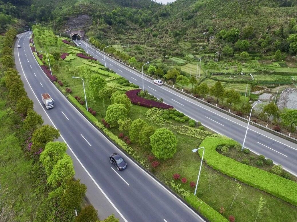
- The construction of Xinjiang Highway 218 will optimize Xinjiang's highway network and further cover residential areas along the route
On June 3, 2021, Xinjiang National Highway 218 Nalati to Balentai highway government and social capital cooperation PPP project, the starting point is located at the Alshan Pass on the east side of Nalati Town, and the opened National Highway 218 to Dun Mazha The Nalati first-class highway connects smoothly, and the terminal is located near the Xiaxinguang Railway Station on the north side of Balentai Town. It is connected to the G0711 Wuwei Expressway in the form of a hub interchange. The total investment is 23.7 billion yuan.
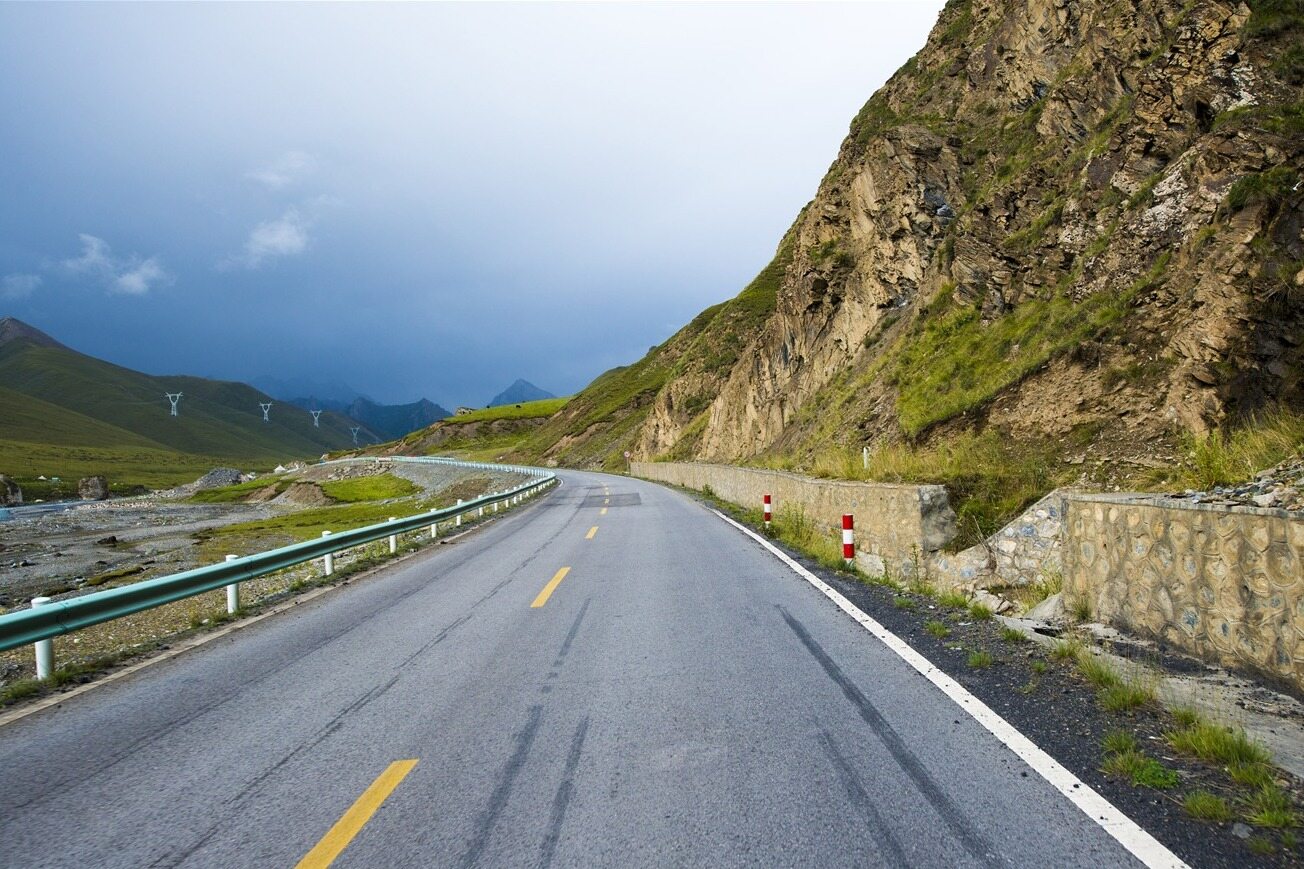
Condition along Highway 218
The starting point of the proposed project’s route is located at the east of the Arshan Special Administrative Village in Nalati Town, at the K319+000 pile number of the first-level highway of the National Highway 218, and then the route enters the Gongnais River Valley, connected by a bridge and tunnel. After passing the intersection of G217 and National Highway 218 (zero kilometers), the route leaves the Gongnaisi River Valley and passes on the north side of Gongnaisi Town, and then the route gradually transitions from routing along the sunny slope of the north bank of the river valley to routing eastward along the river valley. Avoid the landslide group on the north bank of the river valley from Gongnaisi Town to Gongnaisi Forest Farm. Via Gongnaisi Forest Farm, at the junction of Bolostai Saragou and Gongnaisi River, a 7545m extra-long tunnel is set up to cross Aikendaban, and then the route is laid on the slopes of the Bayingol mountain grassland along the south side of the current National Highway 218, with undulating terrain The route is not too big, and the route is straight. After Huoshaoqiao, it continues to extend eastward along the south side of the current National Highway 218. The new and old National Highway 218 forms a fast and slow highway system. The route deviates from the existing National Highway 218 to the south by about 0.5km in the Wuhe Ranch section. , The separation of Wuhe pasture has been avoided. The route crosses the current state highway 218 to the north of Mujiksaragou on the east side of Wuhe pasture, and runs east to Chahannoldaban along the north side of current state national highway 218. After Chahannuoerdaban, the route has a slight ups and downs. The route is laid along the south bank of the Bayingol River. After crossing its branch ditch many times, the route reaches Mengjin Daoban, which has an elevation of 3100 meters, and then follows the Bayingol River along the river. Next, accompany the current state highway 218 line. Since the natural vertical slope at the bottom of the trench reaches 3.6%, the route needs to be stretched on the relatively gentle slopes on both sides. The route turns to the east at AK493+000 on the east side of Ulandaban. A long tunnel is set up to cross the low mountains and enters Acigou, along the ditch extension line, and crosses the river valley and national highway 218 southward at the AK499+000 of the ditch. Route the route on the mountainside part of the south bank of the national highway, and set up two roundabout tunnels at the Bayingol Harsala Valley to overcome the height difference. The tunnel lengths are 2340 meters and 2845 meters, respectively. The route enters the bottom of the river valley again, at the national road 218 on the south bank of the river valley. The south side slope of the line is routed eastward to Baogedan Village, and crosses National Highway 218, Baogedan River, and then a 6553-meter extra-long tunnel is set up to cross the Brantaban and enter the G0711 line corridor of the Ulastai River Valley. The end point is the same. The total length of the route is 217.604Km. National Highway 218, zero kilometers, Gongnaisi Town, Gongnaisi Forest Farm, Aiken Daban, Huoshaoqiao, Wuhe Ranch, Chahannoldaban, Baogedan, Wuwei Expressway, Laonanjiang Railway, Balentai.
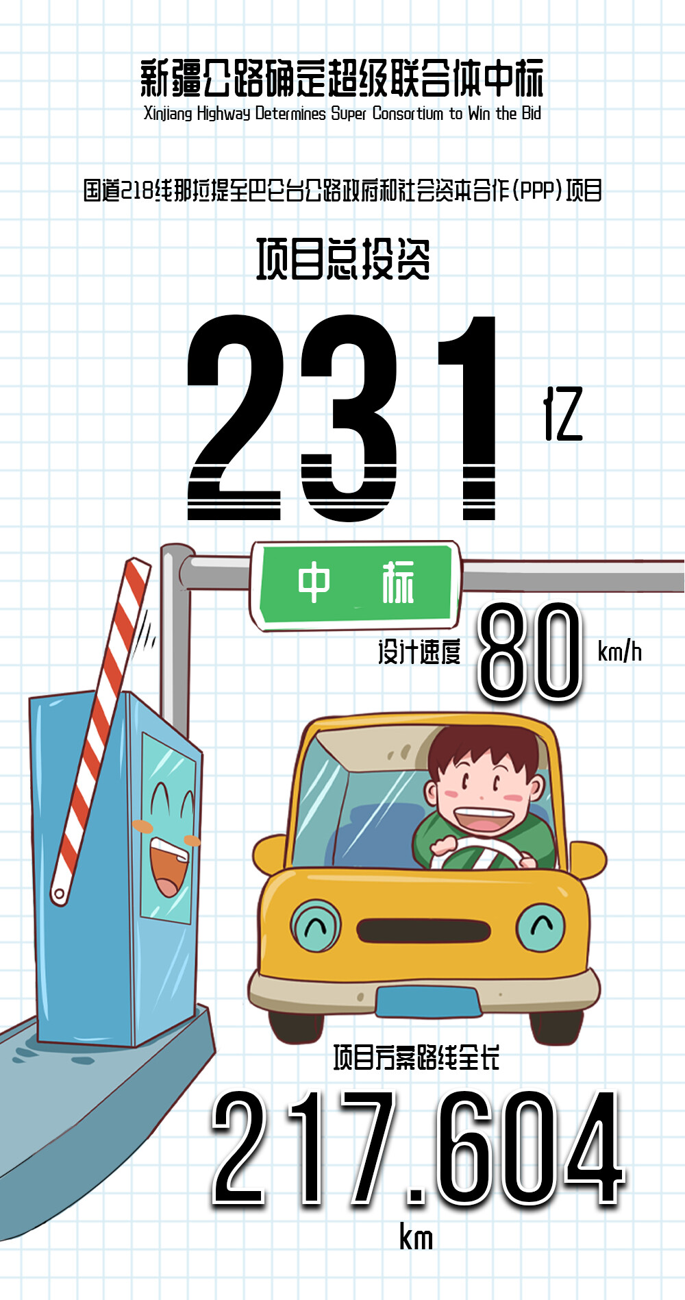
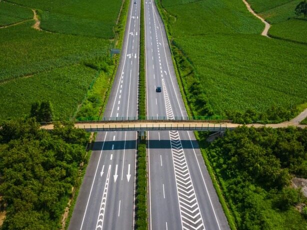
The total length of the project plan is 217.604km. It is constructed according to the four-lane first-class highway standard. The design speed is 80km/h (the design speed of Huoshaoqiao to Chahannuoerdaban section is 100km/h), and the roadbed width is 24.5m (Huoshaoqiao to Chahannuoer). The roadbed width of Daban section is 25m). 41,406 meters/94 bridges across the line (including 2,9483.5 meters/15 large bridges, 9941.5 meters/26 bridges, 1305 meters/21 bridges, and 676 meters/32 small bridges), 182 culverts; tunnels 38220.5m/20 (Including 17508m/3 extra-long tunnels, 13830.5m/6 long tunnels, 4923m/6 medium tunnels, and 5 short tunnels 1959m/5); 5 interchanges will be constructed, 2 reserved Connected to the project) Construction conditions, 1 U-turn, 3 separation interchanges, 24 passages (4 bridge passages, 20 culvert passages), 2 flyovers, 2 service areas, 5 parking areas , 3 maintenance work areas, 2 tunnel management offices, and 1 viewing platform at Chahannoldaban.
Keywords: engineering construction, engineering news
According to the approval of the feasibility study report, the total investment of this project is 23.748.4 million yuan (including the construction period interest of 1.19885 million yuan), of which the static total investment (construction investment) is 22.54.56 million yuan, including construction and installation engineering fees of 19,234.72 million yuan, land use and demolition compensation The cost is 604.02 million yuan, the other engineering construction costs are 848.94 million yuan, and the reserve cost is 186.189 million yuan. The average cost per kilometer is 109.14 million yuan.Editor/Xing Wentao、Design/Zhangtao
Comment

 Praise
 Collect
 Comment

 Share
Share


Write something~